The middle-western beach of Poros is smooth. It is 1.020m long, it beguns from Stavros and reaches the western pier of the island's port The northwestern beach is 880m long, it beguns from the western pier of the port and reaches the canal of Progymnastirion. The town of Poros is built on that beach.
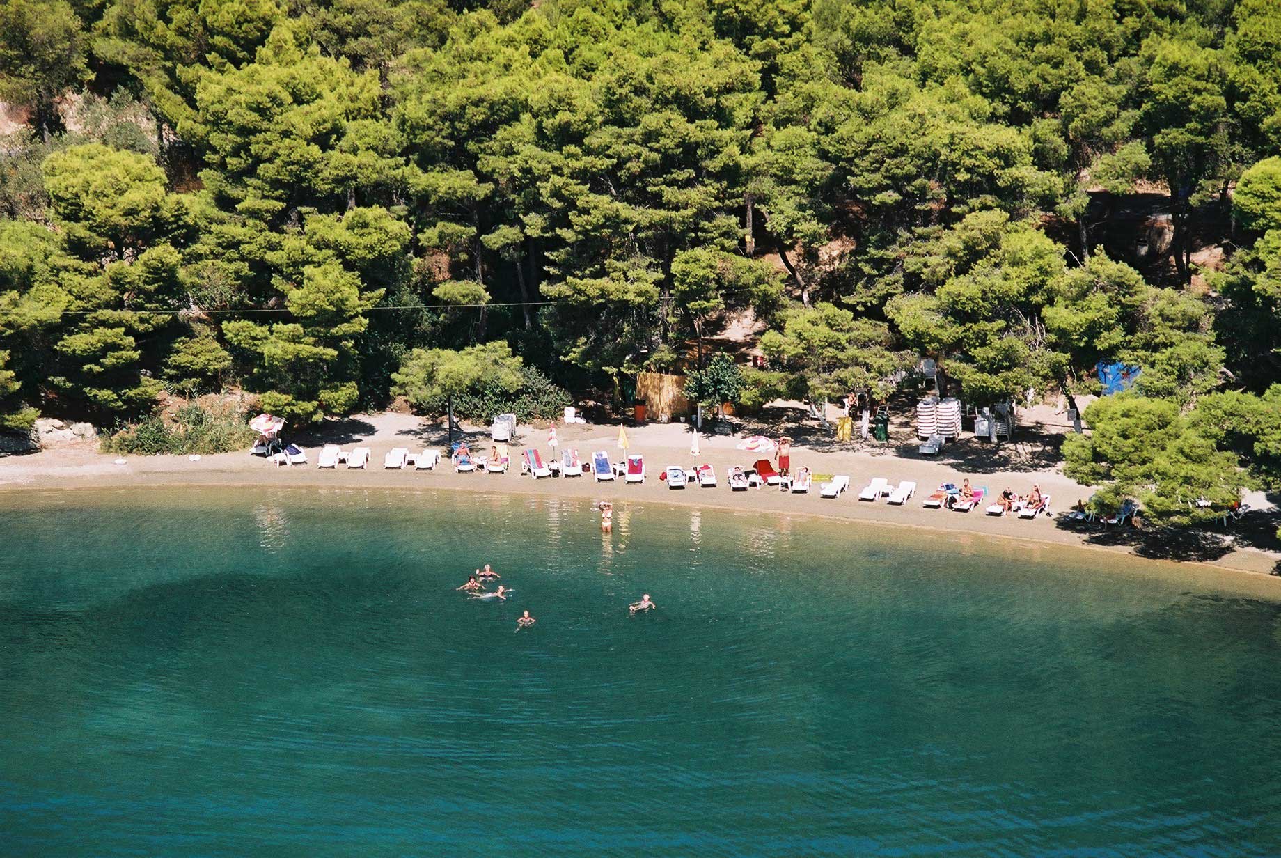
In total the beaches of Kalavria are 39.825m long. They are steep and rocky, though at the west side are smoother. They shape many capes, anchorages and bays. From the little bridge of Progymnastirion till the "Boudouri" (Kolones) cape, the beach is smooth, picturesque and almost straight.
From "Kolones" cape till the "Neda" one, the coast is smooth and picturesque as the pines reach the sea. From "Neda" cape till the "Dana" one, the coast is 1900m long and between the two capes the anchorage of “Terolimani" is shaped, at the entrance of which a skerry, named "Petra", is found. At the “Dana” cape's edge a lighthouse was built by the War Navy. Those coasts of Kalavria along with the western and northwestern coasts of Sfaira and the across coasts of Peloponnese shape the bay of Poros, one of the most picturesque, safest and biggest natural harbours of the country.
From “Dana” cape the coasts of Kalavria are steep and reach the anchorage of “Variani” (Pyrkalis), at the cove of which there is a small sandy beech about 200m long. From the anchorage of Variani the coasts are steep as well, are directed to the north and reach the cape of "Αhedo" (Bitsi). The cape of “Bitsi” is the northern spot of the island.
1,5 mile from the cape of “Bitsi” is the barren island named "Plateia", rich in fishes while 3,3 miles is the barren island named "Petrokaravo".
The eastern coasts of the cave of “Bitsi” are rather smooth and shape capes and small anchorages. They are the famous “Limanakia”, shelter of the fishermen in rough sea. At the entrance of the port, the first one towards “Bitsi” that is the biggest and safest one, there is a small barren island that protects it by the north winds. It is named after the cape and is called “Bitsi” too.
As we continue, the coasts become steep and directing to the east they end up to the anchorage of “Barbaria” (Vagiona), where the “Bitsi” peninsula ends. The coasts from the “Bitsi” cape to the anchorage of "Vagiona" are 8.075m long. The anchorage of "Vagiona" is a small anchorage, exposed only to the N-NE winds. It used to be the base of operations for the Barberines' pirates and for that reason it was called anchorage of “Barbaria”. The beach is 500m long and the sea bed is sandy and crystal clear. The area is appropriate for swimming. At the northern side of the anchorage, ruins of a sunk ancient town are visible. The ancient port of Kalavria used to be here. That was the port the armada of the Macedonians with Antipatros as leader came, in order to arrest Demosthenis, who had found shelter at the Sanctuary of Poseidon.
From “Vagonia” the coasts are directed to the east, they become steep and they end up to the cape of “Kalavri”, known as “Modi”, because in about 1400m from the coast two skerries are found, the biggest of which is called “Modi”. The coasts from the anchorage of “Vagonia” to the “Kalavri” cape are 9.300m long. Within that distance, at the location “Skarpeza”, there are three small anchorages, the biggest one of which is called “Makri Avlaki”. From the “Kalavri” cave the coast is rather steep. It follows S-SW direction and with quite a few manoeuvres it reaches the anchorage of Monastiri. That anchorage has a beautiful and clear beach. It is one of the few touristic beaches of the island, where many Greek and foreign people prefer to go swimming. 500M from the beach is the famous Abbey of Zoodohos Pigi. It is the “Monastery”, as it is called today.
From the anchorage of the Monastery the coast is less steep, it follows west direction and reaches to the beautiful beach of Askeli. Askeli is the most beautiful and touristic place of Poros.
It has turned into a resort with unique beauty, where many villas, lodging houses and hotels are built. After that the coast follows west direction once again and, after the quite steep area of Electrici, it reaches the beach infront of the Cemetery and ends up at the bridge of Progymnastirio.
The coast from “Kalavri” cave to the bridge of Progymnastirio is 6200m long.
|